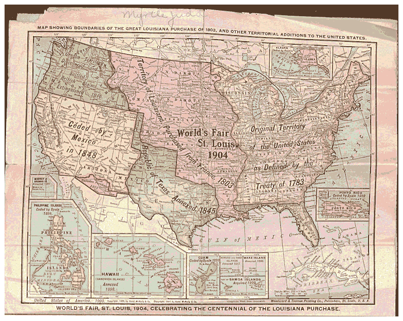
of the US, was copyrighted in 1901; the map promoted and was used well before the St. Louis Fair. It was published by Woodward and Tiernan Publish Co., St. Louis, Mo.
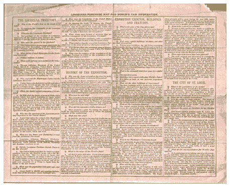
On the back of the map is a great deal of
information about the Louisiana Purchase, what
will be at the 1904 World's Fair and the city of St. Louis. I thank Dan Ruth for providing the excellent photo of this map.
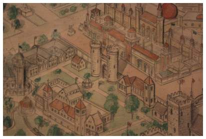
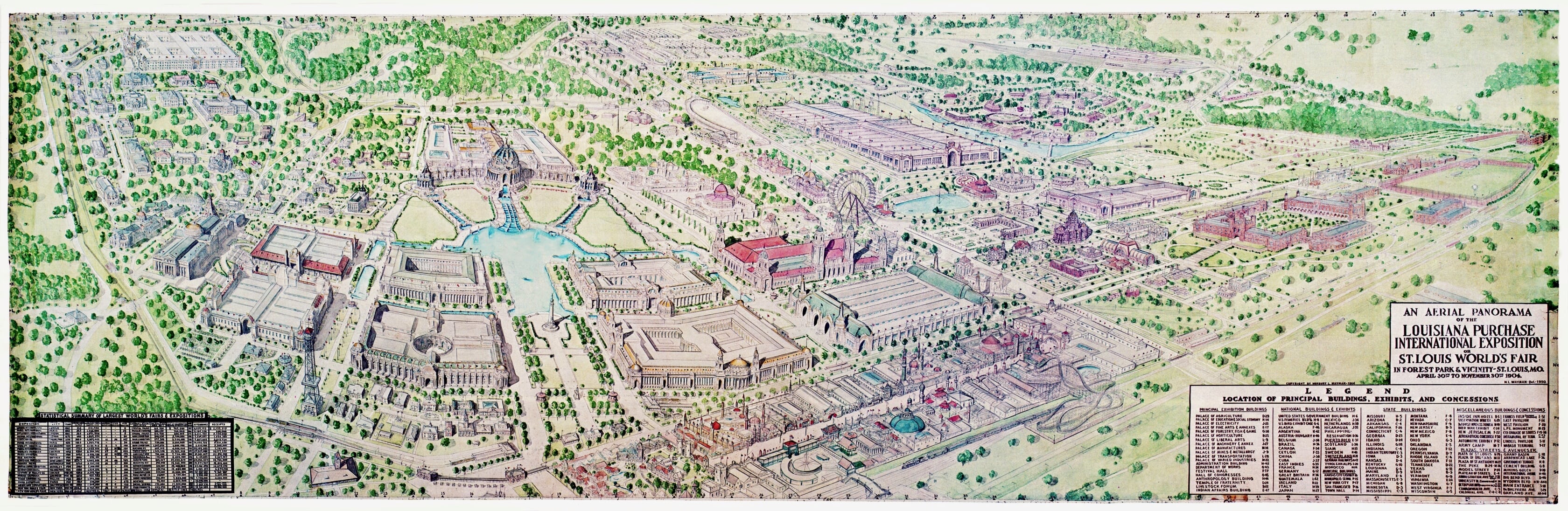
Norbury Lansing Wayman, was a draftsman, historian, and an artist. In 1950, he created an amazing detailed map of the Fair; it's scale rivaled the ambitious proportions of the Exposition itself. Created from pencil and watercolor, this nine by three foot map even showcased the foreground scenic railway, which aerial views usually did not include.
Norbury worked an an enormous amount of maps and aerial work, He chronicled many of St. Louis' historical districts as well as the zoo, the city of St. Louis, Missouri research and many other cities.
Norbury died in 1986.
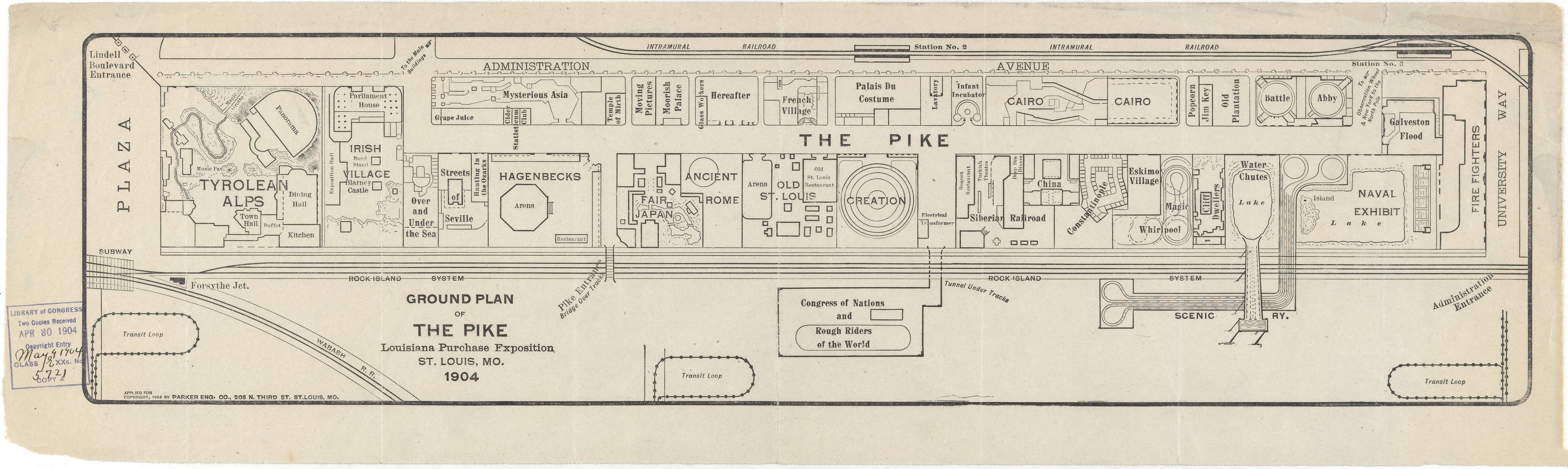
This is a small detail of the above map. Please excuse the color problems with shooting with no flash in the Missouri Historical Museum.
Photos courtesy of: Dan Ruth
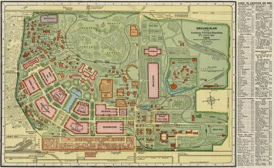
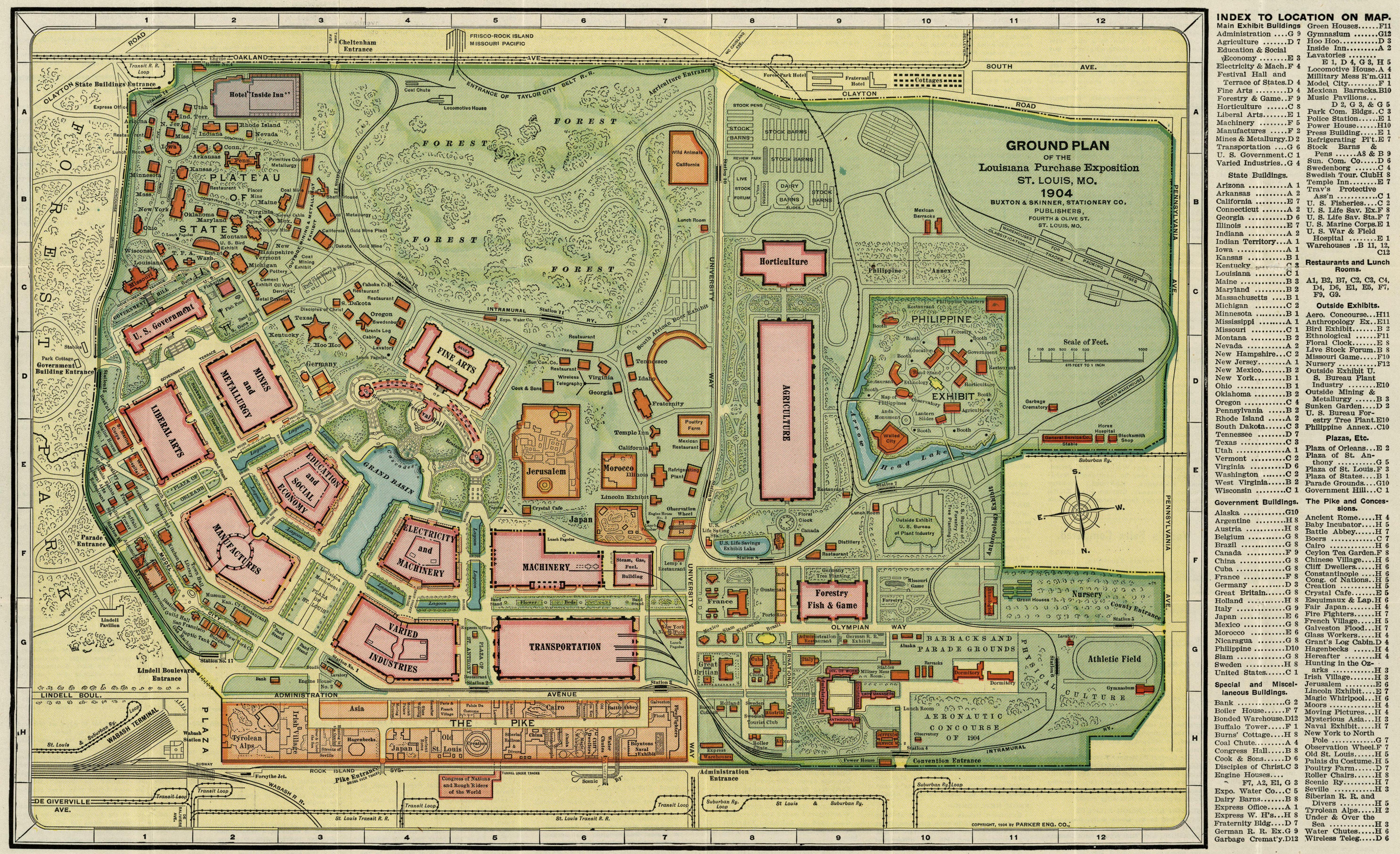
I enlarged this page to house a larger-scaled map, so you can see more detail. The first map is a drastically scaled-down version of what is lower, so you can see the entire Fairgrounds, below this, you can read all the print (albeit blurred). So PLEASE SCROLL DOWN TO SEE THE DETAILED MAP (6,000 pixels wide), and other maps below.